Table of content
- Where Did the Name "Walnut Creek" Actually Come From?
- What Are Some Fun Facts About Walnut Creek's Founding and Early Settlers?
- How Has Walnut Creek's Economy Evolved Over the Decades?
- What Historical Landmarks Can You Still Visit in Walnut Creek Today?
- What Makes Downtown Walnut Creek Different From Other Bay Area Suburbs?
- Why Does Walnut Creek Have More Open Space Than Any Other City in California?
- What's the Climate Actually Like in Walnut Creek?
- Why Work With a Local Team When Buying or Selling in Walnut Creek?
- So What Fun Facts About Walnut Creek Should You Take Away?
- Frequently Asked Questions
KEY TAKEAWAYS
- Walnut Creek started as a Bay Miwok settlement centuries before Spanish explorers named the creek Arroyo de las Nueces, “creek of the walnuts,” in the 1770s.
- The city incorporated in 1914 and grew slowly until Broadway Plaza opened in 1951 and tripled the population within a decade.
- A 1974 public vote preserved 1,800 acres of open space, giving Walnut Creek the highest open space per capita of any city in California.
- The Iron Horse Trail runs 31.77 miles through downtown on the corridor of a former Southern Pacific Railroad line.
- Downtown Walnut Creek is one of the few walkable suburban downtowns in the Bay Area, served by two BART stations, 80+ retailers, and 900+ performing arts events a year at the Lesher Center, and it’s a big part of why the Renée White Team sees so many buyers fall for this city.
If you’ve searched for homes in the San Francisco Bay Area, you’ve probably landed on Walnut Creek at some point. There are plenty of fun facts to discover about Walnut Creek once you look past the listings. Something about this city keeps people here once they arrive. Most of what shows up online is the same short list: Broadway Plaza, BART access, good weather.
The real story goes back centuries, and it’s written into the street grid, the creek tunnels under downtown, and the 1,800 acres of open space that voters chose to protect decades before most cities gave it a thought. If you’re weighing whether Walnut Creek is the right fit or already planning your move to the city, the Renée White Team has worked this market for 21+ years, and we put this guide together for anyone who wants more than the listing photos.
Where Did the Name “Walnut Creek” Actually Come From?
Before American settlers arrived, the area’s dominant feature was a creek lined with native California black walnut trees. Spanish explorers in the 1770s named it Arroyo de las Nueces, “creek of the walnuts.” Early American settlers occasionally called it Nuts Creek before the Post Office made “Walnut Creek” official in 1862.
Before any of that, three Bay Miwok communities (the Saclan, Volvon, and Tactan) had lived in the region for centuries. At their peak, the Bay Miwok population in the broader area exceeded 9,000 people. Spanish missionaries arrived in the late 1700s and disrupted these communities.
The land later became part of Rancho Arroyo de Las Nueces y Bolbones, an 18,000-acre Mexican land grant held by Juana Sanchez de Pacheco. The grant name translates to “walnut creek and Bolbones people,” so the connection between the place and its name runs deeper than a tree: it’s in the region’s Spanish-era land records, long before California became a state.
What Are Some Fun Facts About Walnut Creek’s Founding and Early Settlers?
Walnut Creek began not as a town but as a crossroads. The earliest American settlers called it “The Corners,” named for the intersection of what are now Diablo Boulevard and North Main Street, where roads from Pacheco and Lafayette converged.
- 1849, First American settler arrives: William Slusher arrived the same year as the Gold Rush, becoming the first recorded American settler in the area.
- 1850, Streets are laid out: Hiram Penniman mapped the first streets in the young settlement.
- 1860, Walnut Creek House opens: Milo Hough opened this hotel, which became an early anchor for the growing community.
- Early 1870s, Downtown’s street grid takes shape: Homer Shuey, a cattle rancher, drew up the street patterns that still define parts of downtown Walnut Creek today.
- 1891, The railroad arrives: The Southern Pacific Railroad connected the valley to the broader East Bay, sparking the area’s first real wave of commercial activity.
- 1914, Official incorporation: Walnut Creek incorporated on October 21, becoming the 8th city in Contra Costa County.
At the time of incorporation, Walnut Creek was still a modest agricultural community. Cattle ranching, walnut orchards, and small-scale farming carried the local economy for decades.
How Has Walnut Creek’s Economy Evolved Over the Decades?

The Retail Boom That Changed Everything
The biggest turning point in Walnut Creek’s modern history wasn’t political; it was retail. In 1951, Broadway Plaza opened as Contra Costa County’s first major shopping center. The population tripled within a decade, growing from 2,460 residents in 1950 to 9,903 by 1960, according to U.S. Census Bureau historical data.
That growth never really stopped. Today, Walnut Creek’s population is over 70,000, and the city covers 19.8 square miles. Broadway Plaza has grown into a major open-air retail destination with 80+ shops and restaurants, still anchoring downtown after more than 70 years.
A Diversified Economy Beyond Retail
The economy has spread well beyond retail since then. Shadelands Business Park, in the north of the city, holds a concentration of office and light industrial employers. Several regional corporate headquarters are based in Walnut Creek, and the professional services sector (law, finance, healthcare) has grown steadily alongside the residential base.
Downtown’s Role Today
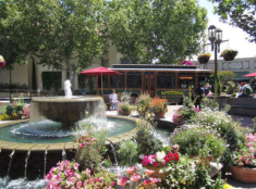
Downtown Walnut Creek offers shopping, dining, live music, and community events year-round, including the Walnut Creek Art & Wine Festival each June and a Sunday Farmers Market from 9 am to 1 pm. For a closer look at how this growth has shaped home values, see our Walnut Creek housing market guide.
What Historical Landmarks Can You Still Visit in Walnut Creek Today?

The history here isn’t locked away in archives. Three places let you see it up close.
Shadelands Ranch Museum
The Shadelands Ranch Museum preserves a 1903 Colonial Revival home that belonged to the Penniman family, one of the city’s founding families. It’s one of the few intact structures from Walnut Creek’s early agricultural era and is run by the Walnut Creek Historical Society. The museum holds records, photographs, and artifacts documenting the city’s shift from ranch land to suburb.
Old Borges Ranch
Old Borges Ranch, in Shell Ridge Open Space, is a working historic ranch you can walk through. It’s a grounded look at early Contra Costa County farming: less polished than most historic sites, more honest.
Lindsay Wildlife Experience
The Lindsay Wildlife Experience is one of the oldest wildlife rehabilitation and education centers in the country. Founded in 1955, it’s rehabilitated over a million animals and works as both a museum and an active animal care facility. The Lindsay Wildlife Experience is genuinely unusual for a city this size.
For the railroad history that shaped Walnut Creek’s growth, the Walnut Creek Model Railroad Society keeps a detailed layout modeled on the Southern Pacific line that once ran through the city before it became the Iron Horse Trail.

What Makes Downtown Walnut Creek Different From Other Bay Area Suburbs?
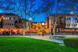
Most Bay Area suburbs are built around cars. Downtown Walnut Creek isn’t. It has bike lanes, a walkable commercial core, and enough foot traffic that a restaurant can stay open without relying entirely on weekend crowds.
A Retail and Arts Anchor
Broadway Plaza, the shopping center that built modern Walnut Creek, has grown well past its 1951 origins.
- It anchors a broader downtown corridor with independent restaurants and wine bars.
- The Lesher Center for the Arts, a four-theater performing arts complex, hosts over 900 performances a year.
- The Lesher Center also houses the Bedford Gallery’s contemporary art exhibitions.
- For a city of 70,000 people, that’s a lot of cultural infrastructure.
Transportation That Actually Works Without a Car
- Walnut Creek has two BART stations, Walnut Creek BART and Pleasant Hill BART, both on the Yellow Line.
- A Downtown Trolley connects Walnut Creek BART to Broadway Plaza on weekdays.
- County Connection runs additional bus service throughout the city.
- Three free shuttles operate within Walnut Creek on weekdays.
- Getting to San Francisco without a car is a real option here, not a stretch.
The Creek Beneath the City
Here’s a detail most people miss: the actual San Ramon Creek, the waterway the city is named for, now runs through tunnels beneath parts of downtown. Walnut Creek was built over its own namesake.
After 21 years in this market, the Renée White Team hears from buyers again and again that walkability is what tips the decision. In the East Bay, that’s a short list of cities, and Walnut Creek is near the top. For a side-by-side comparison with a neighboring city, see Walnut Creek vs. Concord: Home Prices & Which City Fits You.
Why Does Walnut Creek Have More Open Space Than Any Other City in California?
Because residents voted for it, with their own money.
The 1974 Bond Measure
In 1974, Walnut Creek voters approved a $6.7 million bond measure to buy and permanently protect undeveloped land in and around the city. That vote preserved 1,800 acres: Shell Ridge, Lime Ridge, Sugarloaf Open Space, Acalanes Ridge, and additional parcels across the Diablo Foothills. Walnut Creek now owns parts of Lime Ridge and Shell Ridge outright, and Diablo Foothills Regional Park adds another 1,060 acres nearby.
The result: Walnut Creek has the highest ratio of open space per capita of any city in California, according to City of Walnut Creek Open Space data. It took a public vote to make that happen.
Civic Park and the Ruth Bancroft Garden
Civic Park adds 16.7 acres of green space in downtown Walnut Creek, with habitat gardens, picnic areas, playgrounds, and walking paths that see daily use. The Ruth Bancroft Garden, a nationally recognized collection of drought-tolerant succulents and cacti, is also in Walnut Creek, named for longtime resident and botanist Ruth Bancroft. For a full rundown of green spaces across the city, see our guide to the best parks in Walnut Creek.
Mount Diablo’s Influence
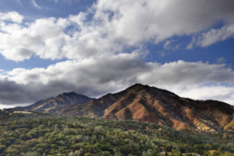
To the east, Mount Diablo, visible from nearly every part of the city, rises to 3,849 feet and shapes Walnut Creek’s local microclimates. A USGS study on California topographic influence on regional climate patterns documents how inland peaks like Mount Diablo affect temperature and rainfall across the surrounding valleys.
What’s the Climate Actually Like in Walnut Creek?

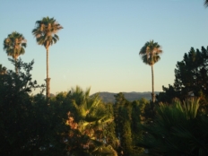
Walnut Creek has a warm-summer Mediterranean climate. The hills to the west block most of the marine layer that keeps San Francisco and Oakland cool and gray through summer, so Walnut Creek gets more sun and warmth than coastal Bay Area cities, without the extreme heat of the Central Valley.
Summer (June–September)
Summer temperatures regularly reach the 80s Fahrenheit (27–32°C). During heat waves, temperatures can top 100°F (38°C).
Winter (November–April)
Winters are mild and wet, and the valley floor rarely sees snow. Walnut Creek gets about 26 inches (660mm) of rain a year, mostly between November and April.
Why the Climate Matters Day to Day
For residents who moved from foggy coastal neighborhoods, the climate shift is usually the first thing they notice, and one of the reasons they mention when asked why they stayed. Outdoor dining works most of the year. Weekend hikes don’t get cancelled by fog. Gardens like the Ruth Bancroft Garden do well here because the climate supports plants that wouldn’t survive closer to the coast.

Why Work With a Local Team When Buying or Selling in Walnut Creek?
Facts and history explain why people fall for Walnut Creek. Actually buying or selling here is a different skill, one that depends on knowing which streets flood in winter, which school boundaries just shifted, and which downtown condo HOA has deferred maintenance nobody’s mentioning yet.
- The Renée White Team has worked exclusively in Contra Costa County for more than 21 years.
- The team has closed over 1,600 transactions with a 99% client satisfaction rate.
- Listings average 23 days on the market, reported through Real Trends Small Teams rankings and regional MLS data (Bay East MLS, CCAR MLS, and BridgeMLS).
- That track record puts the team among the top real estate groups in California by transaction volume.
None of that replaces doing your own research, which is what this article is for. But when it’s time to act on that research, a team that already knows the market’s particulars is worth having in your corner. Whether you’re comparing neighborhoods, timing a sale, or just want a second opinion on a listing, the Renée White Team is a call away.
So What Fun Facts About Walnut Creek Should You Take Away?
People ask why residents who move to Walnut Creek tend not to leave. The honest answer is that it’s not one thing; it’s the accumulation of everything this guide covers. A city that began as a crossroads called “The Corners,” built its modern identity around a shopping center in 1951, voted to permanently protect 1,800 acres of open space in 1974, and has spent the decades since adding trails, performing arts, walkable streets, and a downtown that actually functions as one.
If you’re considering Walnut Creek and want to talk through neighborhoods, school districts, or what specific streets actually feel like to live on, the Renée White Team has been having that conversation in Contra Costa County for over 21 years.